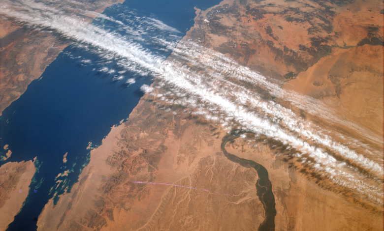
Sixty years ago this month, the last crewed flight of NASA’s Gemini program helped lay groundwork for something beyond the Moon race: a dedicated satellite system for studying Earth. Astronauts James A. Lovell Jr. and Edwin E. “Buzz” Aldrin Jr. orbited the planet aboard Gemini XII from November 11 to 15, 1966, and the photographs taken during their mission, along with those from earlier Gemini and Mercury flights, became part of the argument for Earth observation from space.
Gemini XII’s primary objectives
Gemini XII’s central goals were operational. Lovell and Aldrin completed rendezvous maneuvers and spacewalks, both procedures considered vital to sending American astronauts to the Moon. Alongside that work, the crew contributed to a separate field of exploration: looking back at Earth.
From orbital photographs to an Earth-observing program
Images captured by Lovell, Aldrin, and other Gemini astronauts showed how useful orbital views could be for studying Earth’s surface. Scientists drew on that record when making the case for a dedicated Earth observation satellite program.
One of the strongest advocates for speeding up the use of Earth-observing satellites was William T. Pecora, who directed the United States Geological Survey from 1965 to 1971. In a 1969 statement, Pecora said the Earth Resources Observation Satellite (EROS) program, which he championed, was conceived in 1966 largely because Mercury and Gemini orbital photography had demonstrated its value for Earth resource studies.
EROS later paved the way for Landsat, the satellite series that grew out of that early effort.
A legacy in continuous monitoring
For more than five decades, Landsat and other Earth-observing satellites have supplied data used worldwide to track crops, wildfires, flooding, vegetation health, and land use, along with many other changes to the planet’s surface.
Gemini XII is best remembered as the mission that closed out a program built to prepare for lunar flight. Its photographic legacy, however, also connects to the origins of the long-running satellite record of Earth that scientists and resource managers rely on today.
Source: www.nasa.gov